27 November, 2005


Painted Rocks Petroglyph Site.


The Hohokam lived here until 1450 A.D.


An ancient volcano spewed these basalt rocks here eons ago.


This site contains the most numerous and diverse petroglyphs I have ever seen. There were at least three hundred individual pictures.


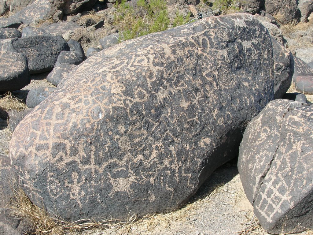
The Hohokam used rock hammers to peck away at the upper layer of rock


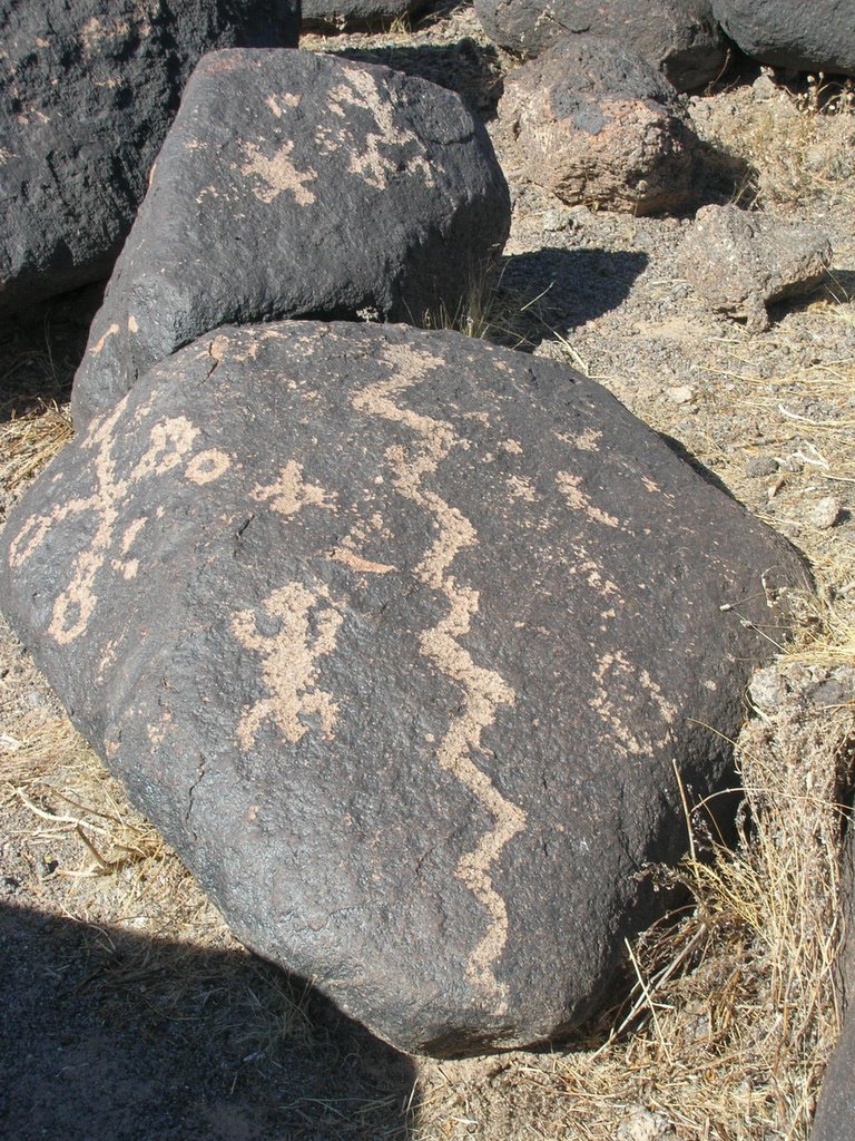
Here is a fine example of a snake. Some lizards are etched on both rocks. There is a cross on the left. The circles represent the sun and moon.


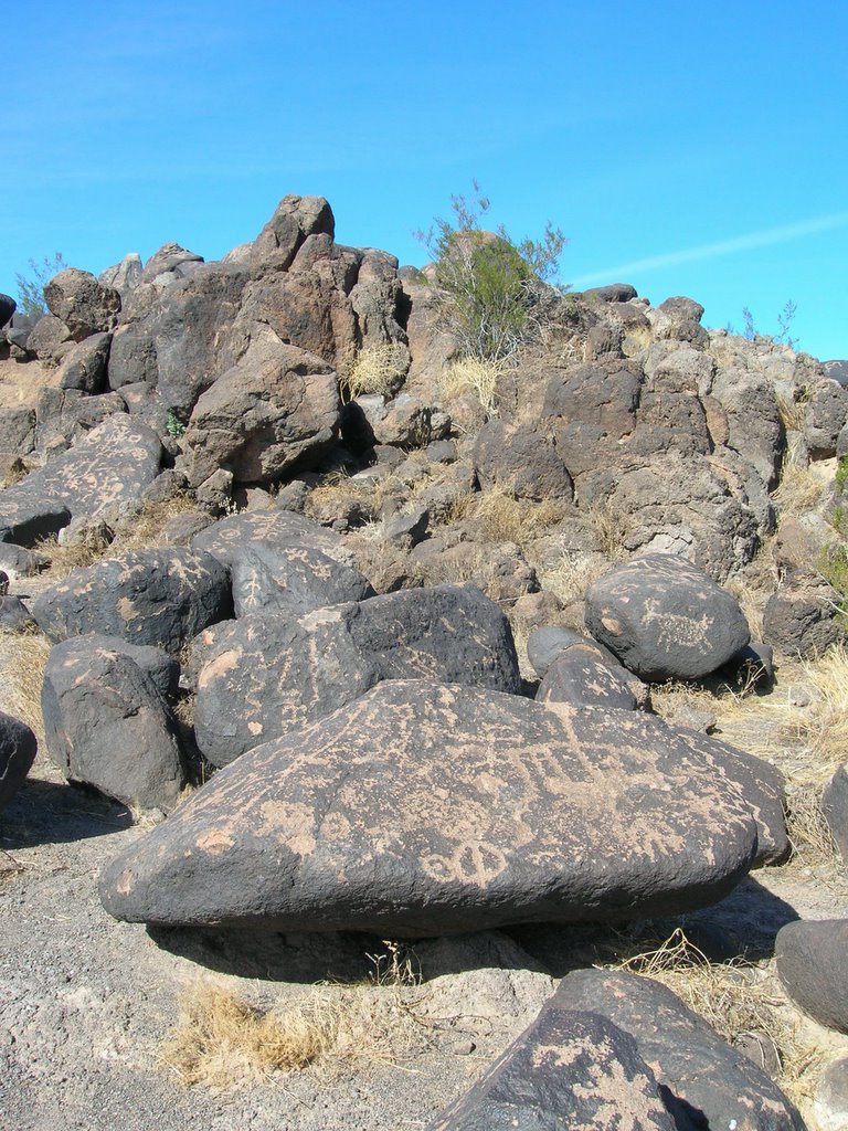
Tahoe and I were among only a handful of visitors that day, but I was still surprised that there was not a guard, fence, or even a railing around these ancient relics.


This is my favorite; it is a big horn sheep.


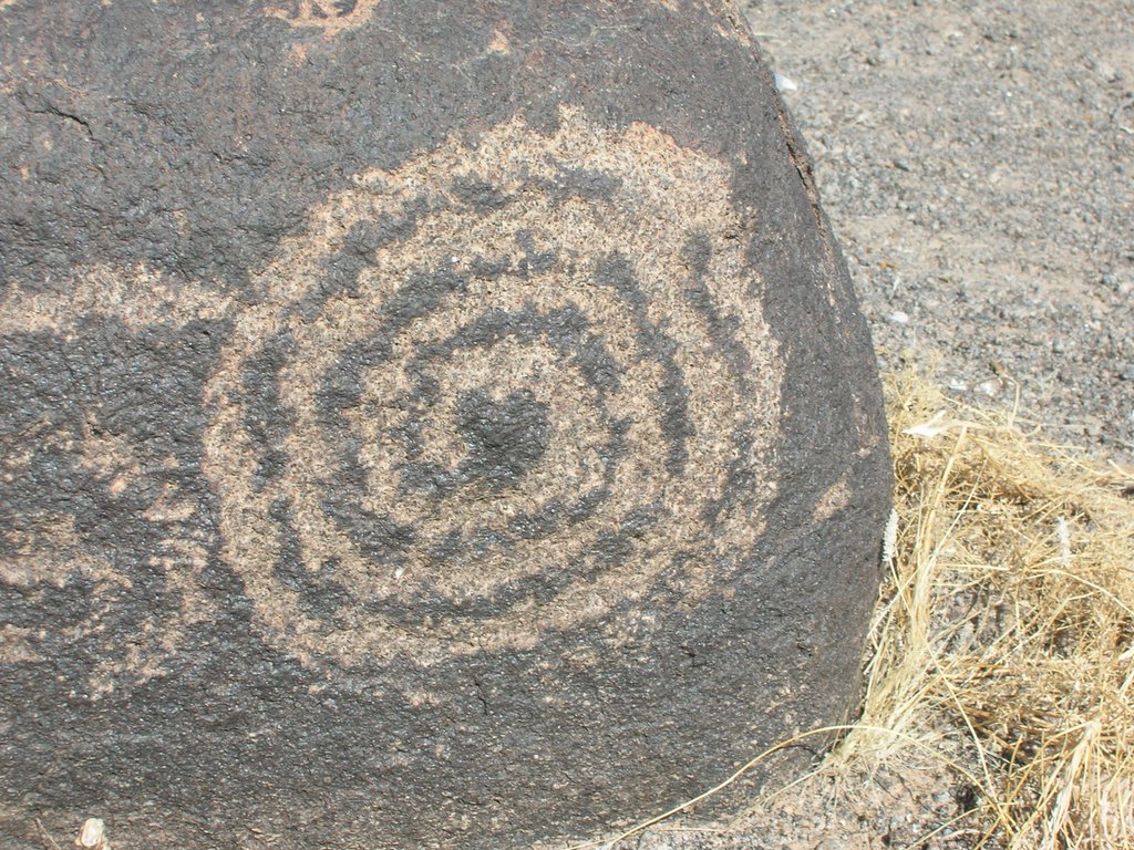
The spiral signifies emergence, water, and growth.


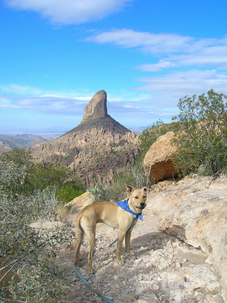
Tahoe was careful not to touch the rocks while he looked for pictures of dogs.


The Gila River is three miles away which explains the abundance of animals including snakes, turtles, and deer.


I thought this shadow was cool.

26 November, 2005


Peralta Trail.


Superstition Mountain Wilderness.


The day was cloudy and windy.


Each wall displayed millions of years of geological history.


The rock formations were great. There were balanced rocks, hoodoos, and spires.


The trail was 6.3 miles round trip. What a spectacular view at the top!


Wind and water form windows like this one.


My favorite trails end with a sweet reward.

This is Weaver's Needle.


It is a dramatic volcanic plug that rises 4,553 feet in elevation.

Me & Tahoe.


Josh was happy to finally get a picture of both of us looking at the camera. Posted by Picasa

25 November, 2005


Salt River.


It was a beautiful day - 75 degrees.


The river was higher than it has been in a couple years.


Josh & Tahoe boulder hopping.


We hiked along the river bank for several miles.


We hung out on the beach area.


This kid was dragging clumps of grass over to the river, throwing it in, and watching it float down with the current.


Papago Park.


This is the view of Tempe from "Hole in the Rock."


Indians used to live in this area.


Red sandstone buttes.


Yellow fruit on staghorn cholla. Javelinas like to eat these.


We hiked up this ravine.


This is the southwest view of Camelback Mountain.


You can barely see South Mountain in the distance.


Tahoe had fun chasing quail and jack rabbits.


We walked around the small pond.


Resident mallards.

Cactus Wren. Posted by Picasa


I got an action shot of new home construction.

19 November, 2005


Pass Mountain Trail.


This is the Usery Mountain Recreation area.


A barrel cactus.


We explored part of this wash and found some quail.


Saguaro arms.


The mountain walls were orange and yellow.


Prickley pear pad.

Gimme five.


The trail was 7 miles and took us three and a half hours to complete.


This lizard was doing push ups.


Palo verde.

It means green stick in espanol.


I could see over a hundred miles away.


Pink thorns.


We saw several horses, and Tahoe got a chance to see one up close. He smelled it and then decided to bark at it.


Dancing saguaro.


The desert vegetation was spectacular.


Nest in chain fruit cholla.


The yellow layer is volcanic tuff.


Yes, here is another nest. I can't help it; they are just so neat.