Travels With Kerri
"Not All Who Wander Are Lost"
31 March, 2007
21 March, 2007
Salt & Sand in Death Valley
 This is Badwater, the lowest point in the States. It's 282 feet below sea level. The ground is covered with salt. There is a huge alluvian fan and Telescope Peak in the back.
 Star dune surrounded by traverse dunes.
 Steep traverse dune.
 Ants, lizards (the same color as sand), rabbits, birds, and foxes live on the dunes.
 Dried mud.
Lizard tracks.
20 March, 2007
Cliffs & Canyons in Death Valley
 Death Valley is full of great names like Furnace Creek, Desolation Mountains, and Last Chance Canyon. This weird landscape is called Devil's Golf Course. It used to be a lake, and now it is gnarled earth and huge salt crystals.
 These hills are called Artist's Palette. The greens, blues, pinks, and yellows were amazing.
 Red canyon wall with sage.
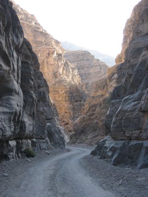
 I hiked through Titus Canyon and saw lots of wildlife.
 After spending a few days in the 100 degree heat, I decided to backpack up Wildrose Peak and camp in the forest. It was much cooler at 9062 feet. Here's a view from the top, looking down at Badwater.
 Golden Canyon was a really fun hike along sandstone cliffs.
 A breathtaking view of Zabriskie Point.
 The lake at Ash Meadows Wildlife Preserve.
The spring was soooo blue.
17 March, 2007
Mojave National Preserve
 Mojave is mostly desolate wilderness. It was quiet and clean.
 Joshua tree blossoms.
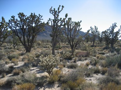
 Joshua tree forest with creosote and cholla.
 I hiked along the Kelso Sand Dunes. The tallest were 700 feet high.
 Beetle tracks and mouse tracks.
 I camped at Eagle Mountain and was visited by a coyote during the night. It sniffed around my tent and left.
 Shoe tree, in the middle of nowhere.
 Baker is home to the World's Tallest Thermometer. You can't really see the digital numbers on the photograph, but it read 75 degrees.
16 March, 2007
Anza-Borrego
 I travelled in the deserts of California for spring break this week. I started in Anza-Borrego. It is named in honor of Juan Baptiste de Anza (a mormon explorer in the 1800's) and bighorn sheep (sheep is borrego in Spanish).
 This slot canyon was a lot of fun, but it was too short, only about a half mile. It was only a couple feet wide in some places, so I had to move sideways.
 View from a wind cave.
 This is Elephant Knees. I hiked up Mud Hills wash to the base of them and was surprised to find oyster shells everywhere. This land all used to be under the ocean about 2 million years ago.
 These pictographs were made by the Kumayaay people.
 These grooves in the rock are called morteros. The indians ground seeds and nuts in the same places for thousands of years and created these smooth holes.
 I camped on this cliff overlooking the badlands and the Salton Sea (way in the back) one night.
A spring flows through Borrego Canyon, and this native palm tree grove creates a real oasis in the desert.


